Blog
RSS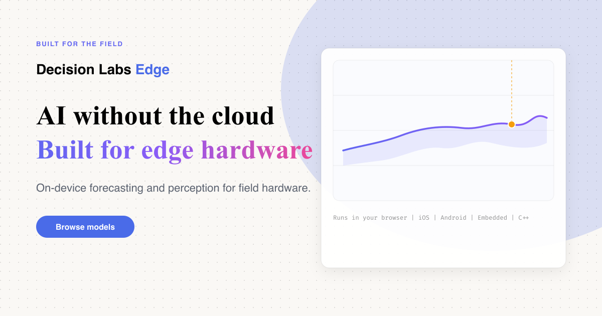
Announcing Decision Labs Edge
We are launching Decision Labs Edge: on-device AI weights and tooling for hardware that cannot rely on a stable cloud…
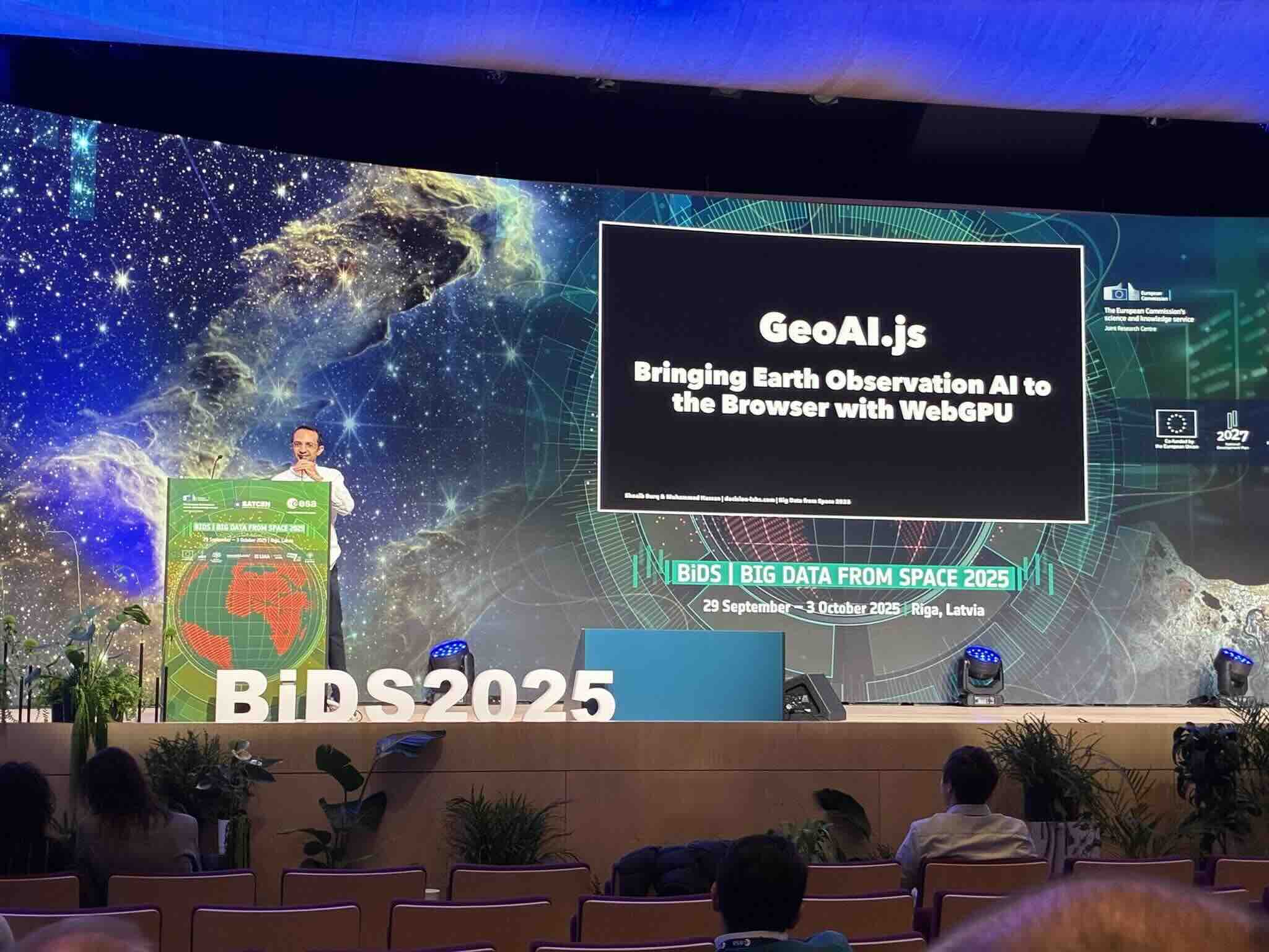
AI Agents for Earth Observation: Talk and BoF at BiDS 2025
At Big Data from Space 2025 (BiDS) in Riga, Latvia, we ran two sessions on agentic AI for Earth observation: a talk on…
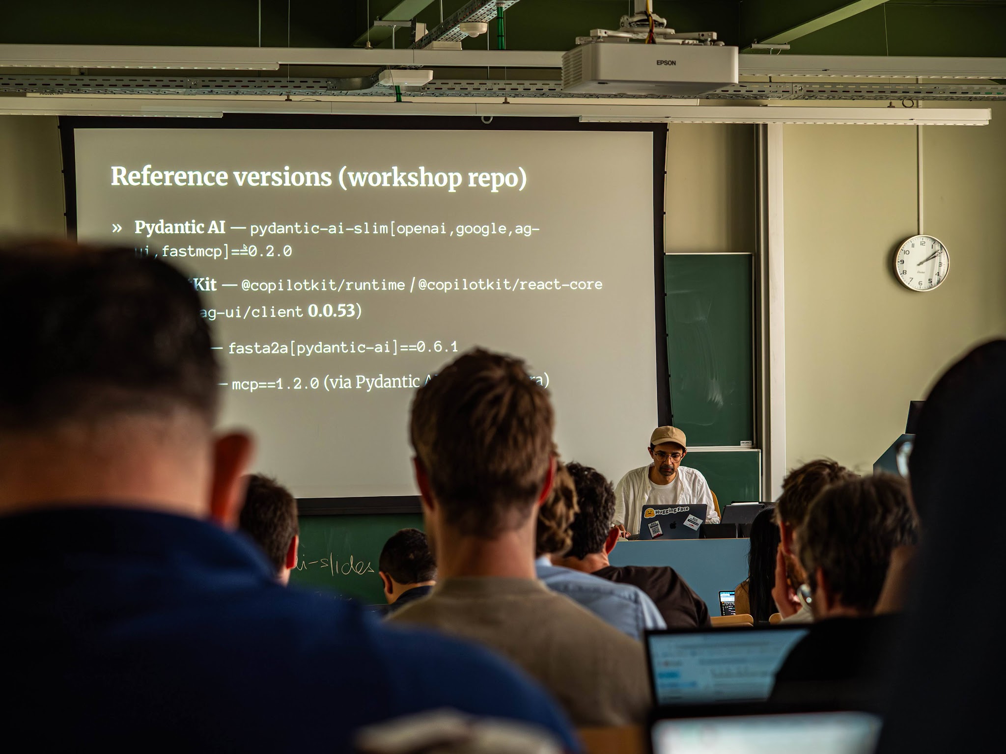
Building GeoAgents: Workshop at GeoAI 2026
We attended GeoAI 2026 in Ghent, Belgium (3 to 6 June 2026) and ran a pre-conference workshop on the afternoon of 3 June…
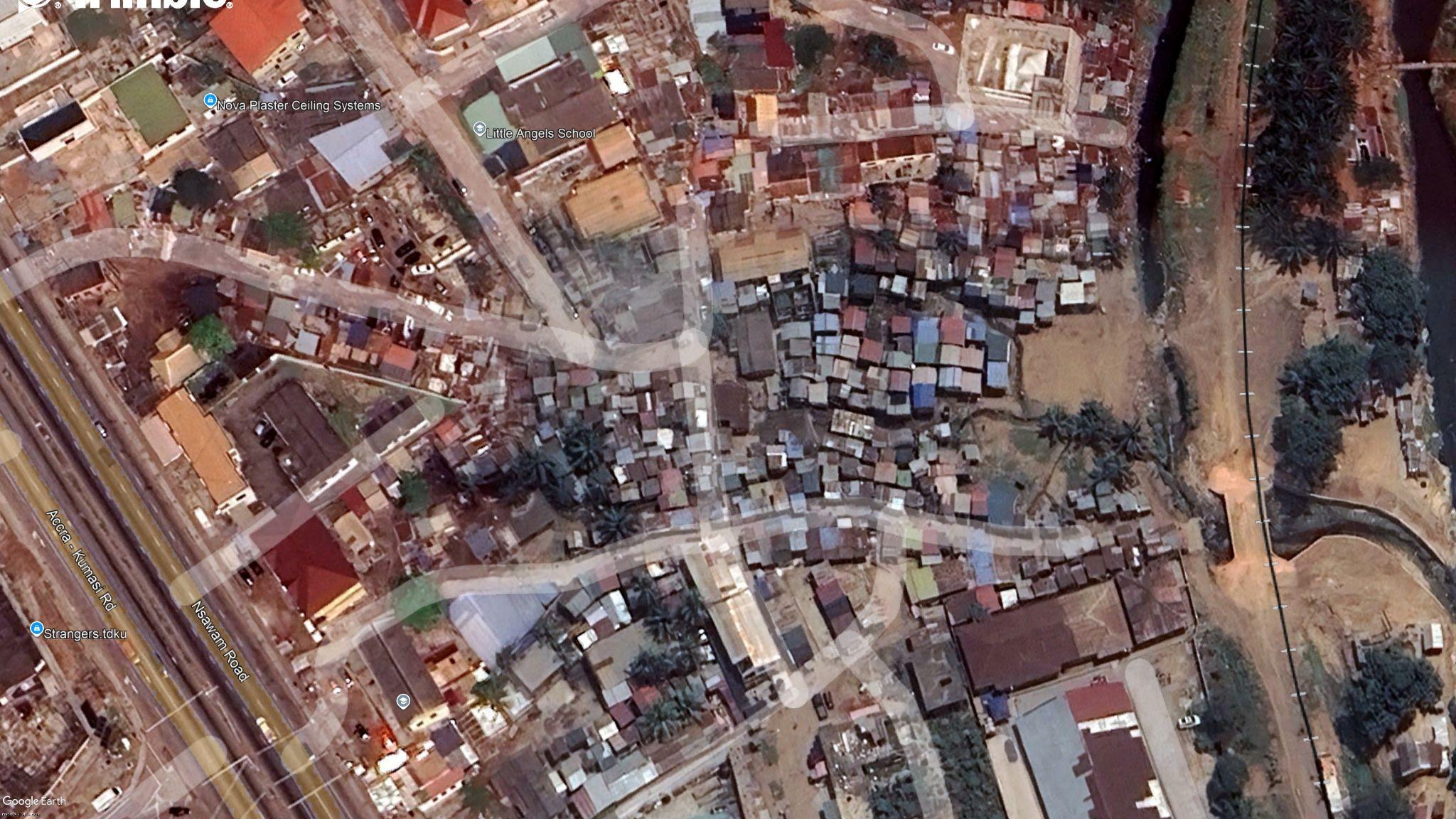
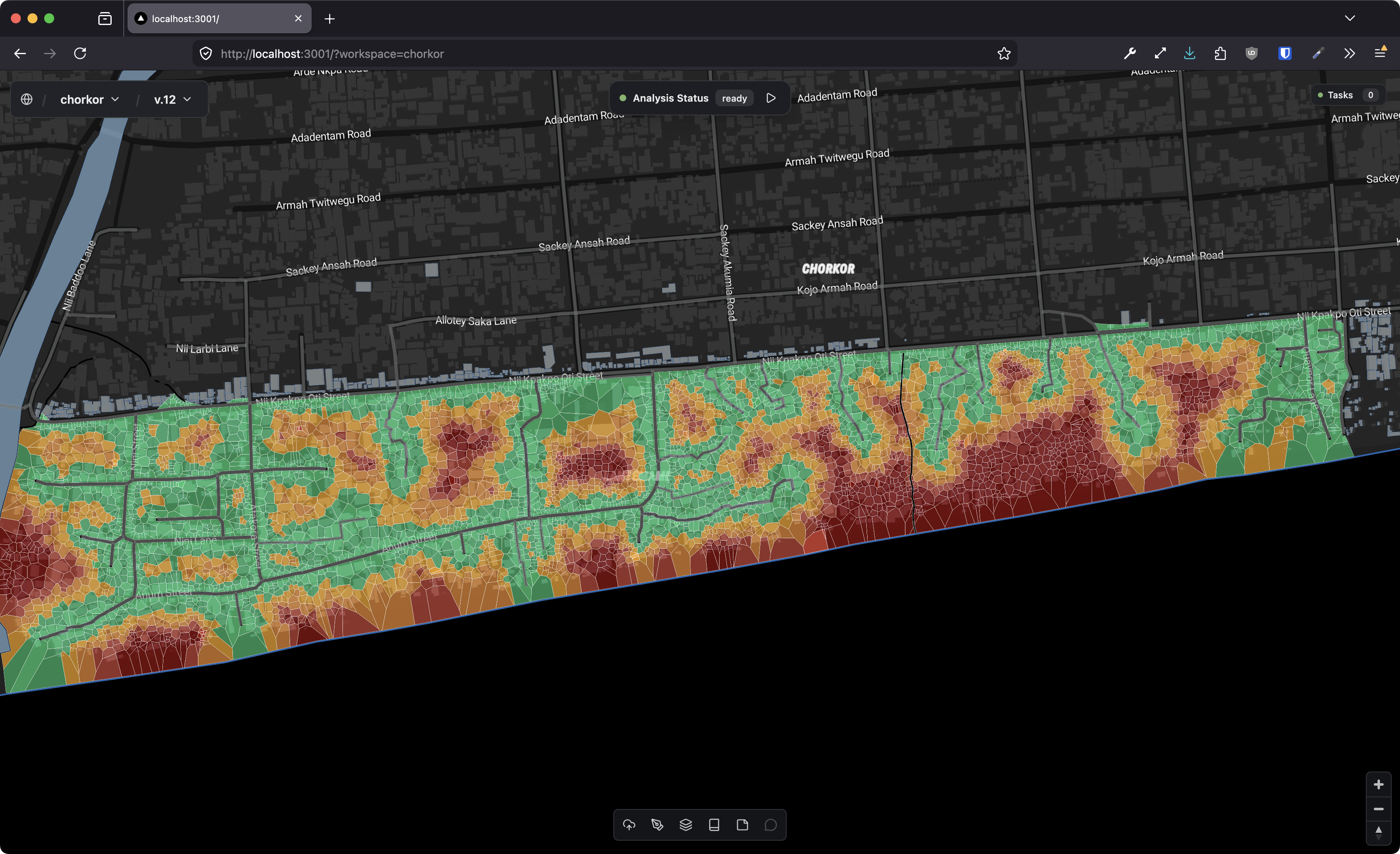
Field Notes: Accra
Alogboshie-Achimota sits on the northern edge of Accra, wedged between a main road and the Achimota forest reserve. From…
Rethinking Roofs: Cooling Homes in Informal Settlements with What Already Exists
In Kroo Bay, Freetown, 91% of homes have corrugated zinc or metal roofs. On a hot afternoon, those roofs turn living…
The Real Cost of Random I/O in Spatial Queries
Plan flips are normal in a cost-based optimizer, until they are not. The recent Clerk incident put attention back on a painful failure mode: a query crossing into a much worse plan after statistics/cost assumptions shift, causing a database

AI Deepfakes From Space — Recorded at Web Summit Qatar 2026
Recorded live at Web Summit Qatar 2026, Shoaib Burq joins Ania Lichtarowicz — former BBC journalist and host of the 'Somewhere on Earth' Global Tech Podcast — to discuss the growing threat of AI-generated and manipulated satellite imagery. He explains how the ESA-backed Verisat AI project detects hidden fingerprints left by generative diffusion models — helping governments, journalists, and humanitarian organisations tell real Earth observation data from artificial deception.
PostGIS Day 2025 Talk Now Live - Working with Geospatial Embeddings
Watch our talk from PostGIS Day 2025 on working with geospatial embeddings and how they're transforming spatial data analysis.
GeoEmbeddings Private Beta - Join Early Access 🚀
We're excited to announce the private beta for GeoEmbeddings. Join early access to explore geospatial embeddings and transform how you work with spatial data.

Announcing the Release of geoai.js 🚀
We're thrilled to announce the release of geoai.js, a powerful JavaScript library for geospatial AI applications. Build intelligent spatial applications with ease.

Geobase now supports DuckDB 1.1.3 🎉
We're excited to announce that Geobase now supports DuckDB 1.1.3, bringing enhanced performance and new features to your geospatial workflows.
We launched! Join us for Beta!
After months of development, we're excited to announce that Geobase is now in beta! Join us and help shape the future of geospatial infrastructure.
Announcing the Globhe Partnership
We're excited to announce our partnership with Globhe, bringing together cutting-edge geospatial infrastructure with innovative drone data solutions.
Pushing the boundaries of geo data with motherduck and geobase!
Explore how we're pushing the boundaries of geospatial data processing by combining MotherDuck's analytics capabilities with Geobase's spatial infrastructure.
Blueprints - Prebuilt Applications Templates
Introducing Blueprints: prebuilt application templates that help you get started with Geobase quickly. Build production-ready geospatial applications in minutes.
How Geobase is Democratizing Access to the Geospatial Industry
Learn how Geobase is making geospatial technology more accessible, breaking down barriers and empowering developers to build powerful spatial applications.
Our goals and vision for Geobase
Discover our mission, goals, and vision for Geobase. Learn how we're building the future of geospatial infrastructure and making spatial data accessible to everyone.
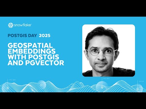
Working With Geospatial Embeddings With PostGIS And PGVector
In this talk, we share how we built geospatial embeddings directly into Geobase.app, our geospatial backend. By extending PostGIS with PGVector, we enabled semantic search and similarity queries over maps, rasters, and vector data sets. We’ll walk through the technical design choices, from embedding generation to storage and retrieval, and show how these capabilities power real-world use cases, such as neighborhood similarity, environmental monitoring, and AI-driven geospatial assistants. The session will highlight lessons learned in integrating modern AI/ML methods with a Postgres-native stack, making advanced retrieval workflows accessible to developers and analysts.